

York County Heritage Trust Sanctioned Civil War Guide Scott Mingus is standing east of Cool Creek Road in the area where the Battle of Wrightsville occurred on the afternoon of June 28, 1863. Wrightsville is behind the trees in the background. The Susquehanna River is approximately one mile from this spot. This view was taken facing northeast at approximately 3:00 PM on Sunday, September 13, 2009.
In today’s post, York Heritage Sanctioned Guide and author Scott Mingus shows us the Wrightsville Battlefield, west of the town.

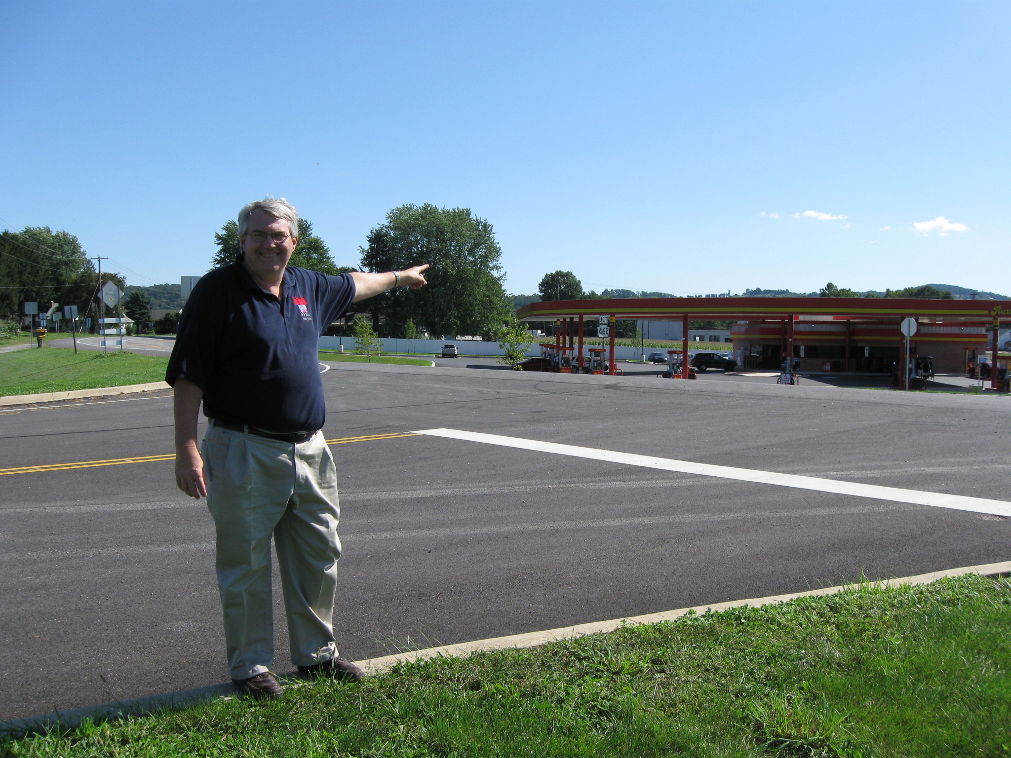
This map shows the location of where our Wrightsville videos were produced. Video #1-#6 were shown in our previous Wrightsville posts. Videos #5 and #6 were taken at the intersection of the Lincoln Highway and Cool Creek Road. Videos #7 -#9 were taken on Cool Creek Road near the Rutter’s convenience store. This map was created facing north at approximately 7:00 PM on Thursday, September 17, 2009.
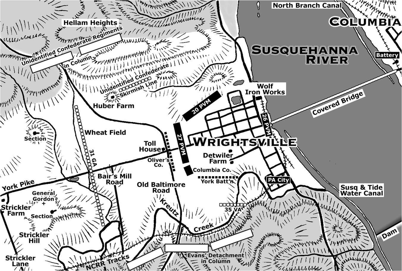
This map shows the units defending Wrightsville and the position of the Confederate units as they advanced on the defenses. Copyright Scott L. Mingus, Sr.; drawn for Flames Beyond Gettysburg by Tom Poston. All rights reserved.
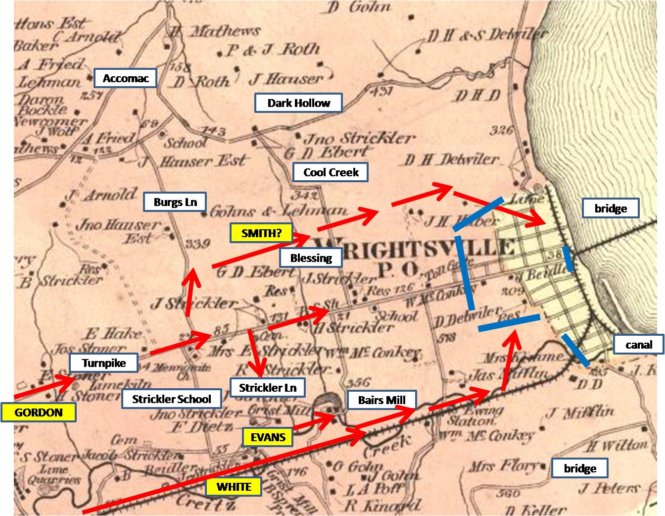
This 1876 map of Wrightsville shows landmarks, Confederate troop movements in red, and the Union defenses in blue. This map was created in 1876.
In Video #7 (Videos #1- #6 were shown in our previous Wrightsville posts) York County Heritage Trust Sanctioned Guide Scott Mingus is standing on Cool Creek Road near the Rutters convenience store. He describes the beginning of the approximately 30 minute fight for Wrightsville which occurred in this area. This view was taken facing southwest to northeast at approximately 3:00 PM on Sunday, September 13, 2009.

York County Heritage Trust Sanctioned Civil War Guide Scott Mingus shows us how much area was occupied by John Brown Gordon’s Confederate Brigade as it advanced towards Wrightsville. To the north, on the ridge in the background where US 30 is now located was Confederate artillery. This view was taken facing north at approximately 3:00 PM on Sunday, September 13, 2009.
The Rutter’s convenience store is in the background. Above the Rutters is a line of trees. Below the trees is Kreutz Creek and the southern advance of Gordon’s Brigade. This view was taken facing south at approximately 3:00 PM on Sunday, September 13, 2009.

The 31st Georgia Infantry Regiment advanced “up the middle” from the west. It is probably not too difficult to tell that we took this picture facing west on a September afternoon. This view was taken facing west at approximately 3:00 PM on Sunday, September 13, 2009.
In Video #8 Sanctioned Guide Scott Mingus is still standing on Cool Creek Road near the Rutters convenience store. He continues his description the primary fight for Wrightsville which occurred in this area and describes the Confederates breakthrough of the Union lines. This view was taken facing northeast to south to northeast at approximately 3:00 PM on Sunday, September 13, 2009.

The J.M. Huber Farm is in the background. This view was taken facing northeast at approximately 3:00 PM on Sunday, September 13, 2009.
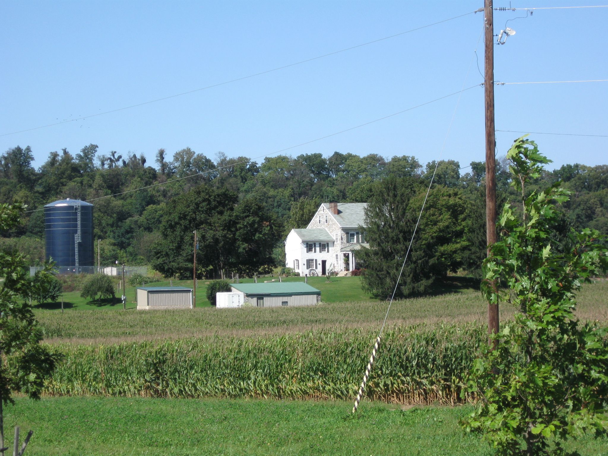
A closer view of the J.M. Huber Farm. This view was taken facing northeast at approximately 3:00 PM on Sunday, September 13, 2009.
In Video #9 Scott Mingus is still standing on the east side of Cool Creek Road near the Rutters convenience store. He points out the location of the Union earthworks in this area and describes how the 20th Pennsylvania stayed too long in their position. This view was taken facing northeast at approximately 3:00 PM on Sunday, September 13, 2009.