On September 7th the National Park Service performed a controlled burn at the Triangular Field area near Devil’s Den. Some parts of the burn appeared to be very effective. We walked around the area before and after the burn to take some panorama shots. On the right is the monument to Captain James Smith’s New York Battery. In the center background is the monument to the 99th Pennsylvania. Our first panorama will be near the monument looking back towards the Triangular Field. Remember to “click” on any of our images in order to make them larger.This image was taken facing northeast at approximately 4:30 PM on Wednesday, September 7, 2016.
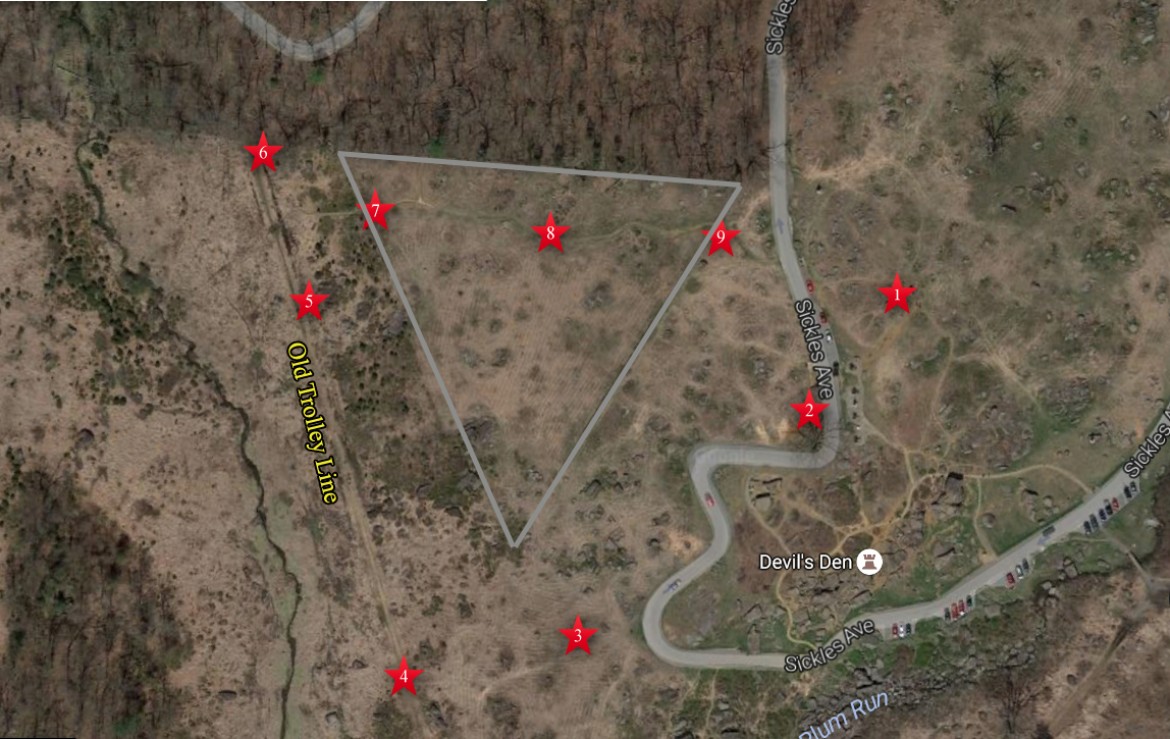
This aerial view shows the area of area of the Triangular Field. The grey lines mark the locations of the stone walls that give the Triangular Field its name. They are grey because you know, they are stones. The red stars mark the locations of the before and after panoramas that we took. This image is courtesy of googlemaps.
Panorama #1 was taken on top of a large rock near the monument to the 99th Pennsylvania Infantry Regiment. This photograph was taken facing southwest to northeast. The “before” panorama was taken at approximately 4:30 PM on Tuesday, September 6, 2016.
Panorama #1 was taken on top of a large rock near the monument to the 99th Pennsylvania Infantry Regiment. This photograph was taken facing southwest to northeast. The “after” panorama was taken at approximately 4:30 PM on Wednesday, September 7, 2016.
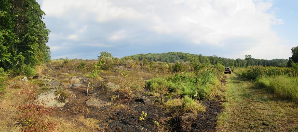
On the day of the fire we got there after the burn, when the firefighters were putting out the “hot spots.”This image was taken facing southwest at approximately 4:30 PM on Wednesday, September 7, 2016.
This image shows the fire crews scouting out the area the day before the burn. The fire personnel were from different parks of the Northeast Region of the National Park Service, including Gettysburg, New River Gorge, Delaware Water Gap, Shenandoah, Gateway, Acadia, Cape Cod, and the Pennsylvania Bureau of Forestry.This view was taken facing north at approximately 4:30 PM on Tuesday, September 6, 2016.
National Park Service spokesperson Katie Lawhon told us that “Our goals are to ‘perpetuate the open space character of the landscape; maintain wildlife habitat, control invasive exotic species; reduce shrub and woody species components, and reduce fuels in wooded areas to reduce fire hazard.'” Panorama #2 was taken near the large “witness tree” at the top of Devil’s Den.This “before” panorama was taken facing south to north at approximately 4:30 PM on Tuesday, September 6, 2016.
As one of the fire fighters informed us, “We are trying to kill the ‘woodies’ so we can promote the grasses.” He clarified for us that “woodies” meant bushes, trees, and saplings. Panorama #2 was taken near the large “witness tree” at the top of Devil’s Den.This “after” panorama was taken facing south to north at approximately 4:30 PM on Tuesday, September 6, 2016.
On our way from Panorama #2 to Panorama #3 we took this picture of the sharpshooter’s position at Devil’s Den, and of the witness tree in the left background. This before picture was taken facing east at approximately 4:30 PM on Tuesday, September 6, 2016.
The next day we came back to take the same picture in case anything changed. Of course nothing had really changed, except for the fire vehicle in the left background, because the fire was behind the camera position. This “after” picture was taken facing east at approximately 4:30 PM on Wednesday September 7, 2016.
On the day of the fire we went to the Benning’s Brigade plaque and there was a red container behind the marker. This view was taken facing southwest at approximately 4:30 PM on Wednesday, September 7, 2016.
The containers can hold as much as 1500 gallons of water. The firefighters we spoke with estimated that they put approximately 1000 gallons of water in the container that morning. This view was taken facing northwest at approximately 4:45 PM on Wednesday September 7, 2016.
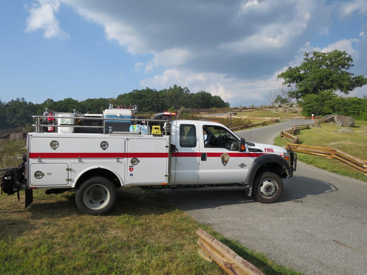
While we were there, one of the vehicles pulled up.This view was taken facing north at approximately 4:45 PM on Wednesday, September 7, 2016.
Joe Russell (left) and Brian Daigle (right) used the hose to fill up their vehicle. Each truck holds approximately 300 gallons.This view was taken facing northwest at approximately 4:45 PM on Wednesday, September 7, 2016.
This is Panorama #3. We have now gone a little way down the slope behind the Benning’s Brigade marker. On the far left is the fire break line that the National Park Service mowed. The Confederates charged from left to right up the hill on the afternoon of July 2, 1863.This “before” panorama was taken facing northwest to northeast at approximately 4:45 PM on Tuesday, September 6, 2016.
This is Panorama #3. Now many more rocks are exposed, but there is still some vegetation. One of the firefighters told us that this vegetation would be dying off at a later time because of the fire. This “after” panorama was taken facing northwest to northeast at approximately 4:45 PM on Wednesday, September 7, 2016.
In Panorama #4 we have moved down the hill to the old Trolley Line.This “before” panorama was taken facing northwest to northeast at approximately 4:45 PM on Tuesday, September 6, 2016.
After the fire there was still a lot of vegetation, including a lot of “woodies.”This “after” panorama was taken facing northwest to northeast at approximately 4:45 PM on Wednesday, September 7, 2016.
For Panorama #5, we’ve walked north along the trolley trail.This “before” panorama was taken facing northwest to southeast at approximately 5:00 PM on Tuesday, September 6, 2016.
This is Panorama #5. Firefighter Tony Davis, from Acadia, explained to us that because of the heat, they had to be cautious and not have as great a fire as they might have if they burned this area at another time. Usually they do these burns during the fall or the spring, not the summer. Many of these “established” cedar trees and these saplings/bushes will not die off at a later time.This “after” panorama was taken facing northwest to northeast at approximately 5:00 PM on Wednesday, September 7,2016.
At Panorama #6 we have reached the point where the old Trolley Line meets the woods on the north side of the Triangular Field.This “before” panorama was taken facing east to southeast at approximately 5:00 PM on Tuesday, September 6, 2016.
This is Panorama #6. The 1st Texas Infantry Regiment climbed the slope towards the top of Houck’s Ridge/Devil’s Den in this area.This “after” panorama was taken facing south to southeast at approximately 5:00 PM on Wednesday, September 7,2016.
This is Panorama #7. We have now reached the area by the western stone wall. From this location, Texas infantrymen aimed at artillerymen from Smith’s New York Battery at the top of the hill.This “before” panorama was taken facing east to southwest at approximately 5:15 PM on Tuesday, September 6, 2016.
This is Panorama #7. The small cedar trees close to the camera are growing in the area of the stone wall.This “after” panorama was taken facing east to southwest at approximately 5:15 PM on Wednesday, September 7,2016.
On the day before the burning, we found these flags and the rubber duck at the stone wall. On the day after the burning they were not here.This view was taken facing south at approximately 5:15 PM on Tuesday, September 6, 2016.
This is Panorama #8. We’ve now moved approximately halfway up the slope between the west and east stone walls.This “before” panorama was taken facing east to west at approximately 5:30 PM on Tuesday, September 6, 2016.
This is Panorama #8. We were told this controlled burn was an experiment. Normally they are not conducted during this time of year. They will come back and check on it later to see if Gettysburg National Military Park approves and wants to continue other controlled burns.This “after” panorama was taken facing east to west at approximately 5:30 PM on Wednesday, September 7,2016.
For Panorama #9, we’ve reached the eastern stone wall near Sickles Avenue. This is a view that members of the 124th New York Infantry Regiment had as they faced Texans coming up the hill towards them.This “before” panorama was taken facing southwest to northeast at approximately 6:00 PM on Tuesday, September 6, 2016.
This is Panorama #9. To our untrained eye, it looks to us like there’s still “a whole lotta vegetation growing on.” Hopefully in the next couple of weeks we will see more vegetation that died off because of the fire.This “after” panorama was taken facing southwest to northeast at approximately 6:00 PM on Wednesday, September 7,2016.
By the way, can somebody let Bill Dowling know that his gate is still here? Well, half of it anyway. This view was taken facing west at approximately 6:00 PM on Wednesday, September 7, 2016.


