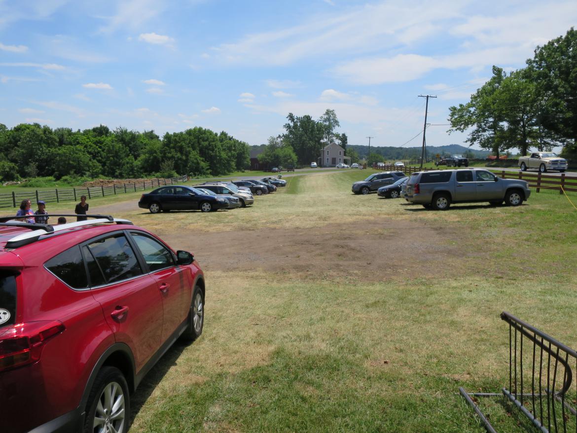
While the old Cyclorama Parking Lot is being replaced (out of sight to the right of this view), a temporary parking lot has been established south of the National Cemetery. This lot used to be used by employees of the National Park Service when the the old Visitors Center complex was located nearby. This view was taken facing northwest circa the early 1900s.
This aerial view shows the area of the temporary National Cemetery parking lot. The parking lot is located south of the National Cemetery. The red star is the spot on which the temporary parking lot is located.. This image is courtesy of googlemaps.
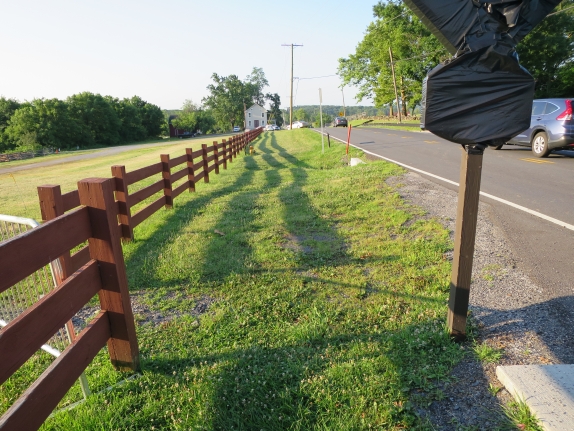
The parking lot is located along the Taneytown Road behind the position of the 3rd New York Independent Battery’s monument. The sign that is covered used to be on the walkway for visitors to cross to the west side of the Taneytown Road. However, with construction occurring on the west side of the Taneytown Road, visitors are discouraged from crossing here. This image was taken facing southeast at approximately 7:30 AM on Wednesday July 20, 2016.”
Unfortunately signs have not been placed along the Taneytown Road informing visitors that this is the parking lot for the National Cemetery. This image was taken facing south at approximately 7:30 AM on Wednesday July 20, 2016.
There were signs on the west side of the Taneytown Road showing visitors that the Old Cyclorama Parking Lot was the new National Cemetery Parking Lot. This sign was covered up, and not moved to the east side of the road to the temporary parking lot. This view was taken facing north at approximately 7:30 AM on Saturday, July 2, 2016.
When we walk along the road, visitors frequently stop and ask us where they can park. In the distance, behind the telephone pole, is a car turning into the temporary parking lot after they asked us for directions. This image was taken facing south at approximately 7:30 AM on Wednesday July 20, 2016.
Walkers who want to get to the National Cemetery from the Visitors Center would take the trail from the Visitors Center to the Taneytown Road. They cannot use the trail on the west side of the Taneytown Road to the cemetery because it is closed due to the construction. They are supposed to cross Hunt Avenue and keep between the yellow ropes on this side of the Taneytown Road. This view was taken facing north at approximately 7:30 AM on Tuesday July 19, 2016.
Visitors continue between the ropes up to the approximate site of the Katharine Guinn House, which is now the law enforcement headquarters for Gettysburg National Military Park. However, they do not want you to walk in front of the house and their vehicles which might have to exit the area quickly. This view was taken facing north at approximately 7:30 AM on Tuesday July 19, 2016.
Visitors will then keep between the ropes and walk past the red barn, and then take a left to go behind the barn. This view was taken facing east at approximately 7:30 AM on Tuesday July 19, 2016.
Visitors then come out behind the barn towards the camera position. This view was taken facing southwest at approximately 7:30 AM on Tuesday July 19, 2016.
This panorama shows the view of the temporary parking that visitors have after they emerge from behind the barn. Notice on the left how there is a sign directing the walkers to keep between the ropes. This view was taken facing northwest to east at approximately 7:30 AM on Wednesday July 20, 2016.
This panorama of the parking lot was taken from the southeast corner of the lot. On the left is the vehicle entrance to the lot. Near the center is the construction “shack” on the other (west) side of the Taneytown Road where the old Cyclorama Parking lot is being deconstructed and constructed. On the right is the wooden fence that separates the temporary parking lot and National Park Service land from Evergreen Cemetery (the private local cemetery) land. This view was taken facing west to north at approximately 7:30 AM on Wednesday July 20, 2016.
If you drove your vehicle into the lot, how do you park? On the grass? What does this yellow rope down the middle mean? Are you supposed to park on either side of the rope? Our first visitor by the stone wall pulled his vehicle in like this. This view was taken facing north at approximately 7:30 AM on Wednesday July 20, 2016.
It’s pretty much up to the first vehicle to set the parking pattern for those to follow. This view was taken facing northeast at approximately 7:30 AM on Wednesday July 20, 2016.
Here is the parking pattern established by Wednesday afternoon of this week. This view was taken facing south at approximately 1:30 PM on Wednesday, July 20, 2016.
Here is the parking pattern established by Thursday afternoon of this week. This view was taken facing south at approximately 2:30 PM on Thursday, July 21, 2016.
Because of the construction occurring in the area on the west side of the Taneytown Road, visitors cannot cross the road to use the sidewalk. To allow them to go directly into the cemetery, a hole was made in this wall. This view was taken facing northeast at approximately 7:30 AM on Tuesday, July 19, 2016.
The hole was placed here because a truck had previously hit the wall here and damaged it. This view was taken facing northeast at approximately 7:30 AM on Tuesday, July 19, 2016.
The National Cemetery is usually open around 7:30 AM and closes at dusk. This view was taken facing north at approximately 7:30 AM on Tuesday, July 19, 2016.
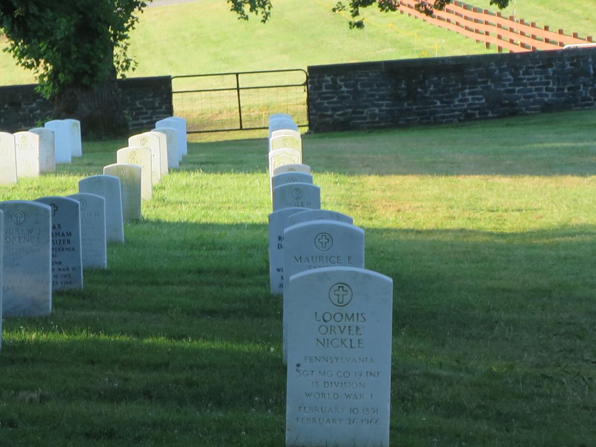
Visitors then walk up the hill, preferably to the left or center (out of sight) of the headstones. This view was taken facing north at approximately 7:30 AM on Tuesday, July 19, 2016.
The camera position is near the top of the hill in the National Cemetery looking towards the gate at the temporary parking lot. This view was taken facing south at approximately 7:30 AM on Tuesday, July 19, 2016.


