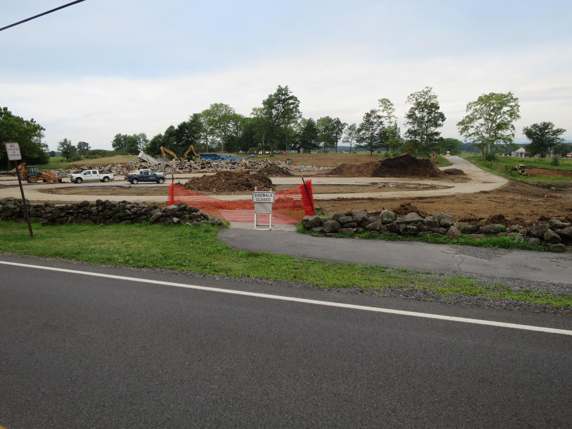
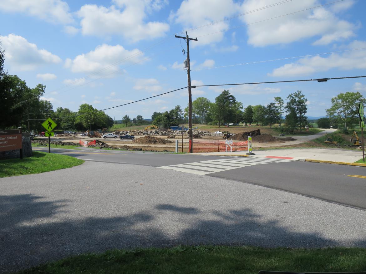
The Hancock Avenue Gate will be put back in this location on the west side of the Taneytown Road. The “Sidewalk Closed” sign is near the center of the gate. The left post of the gate is near the left of the orange fencing. The right post is farther to the right of the orange fencing. The reconstruction of the Hancock Gate is part of the overall plan to put the Old Cyclorama Parking Lot/New National Cemetery Parking Lot to its late 1800s-early 1900s appearance. This view was taken facing southwest at approximately 7:30 AM on Tuesday, August 3, 2016
This aerial view shows the area of the old Cyclorama Visitor Center that is being reconstructed on Cemetery Ridge. The red star is the spot where the Hancock Avenue Gate will again be located.. This image is courtesy of googlemaps.
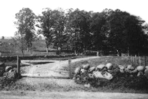
Originally Hancock Avenue had a wooden gate at its entrance along the Taneytown Road. The National Park Service has decided not to put back this gate. This image was taken facing southwest circa the late 1880s.
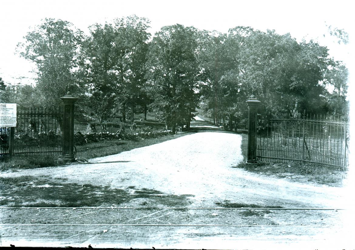
The next Hancock Avenue entrance was flanked by the fencing from Lafayette Square in Washington, D.C. The National Park Service is not reconstructing this fencing. This image was taken facing southwest in 1896.
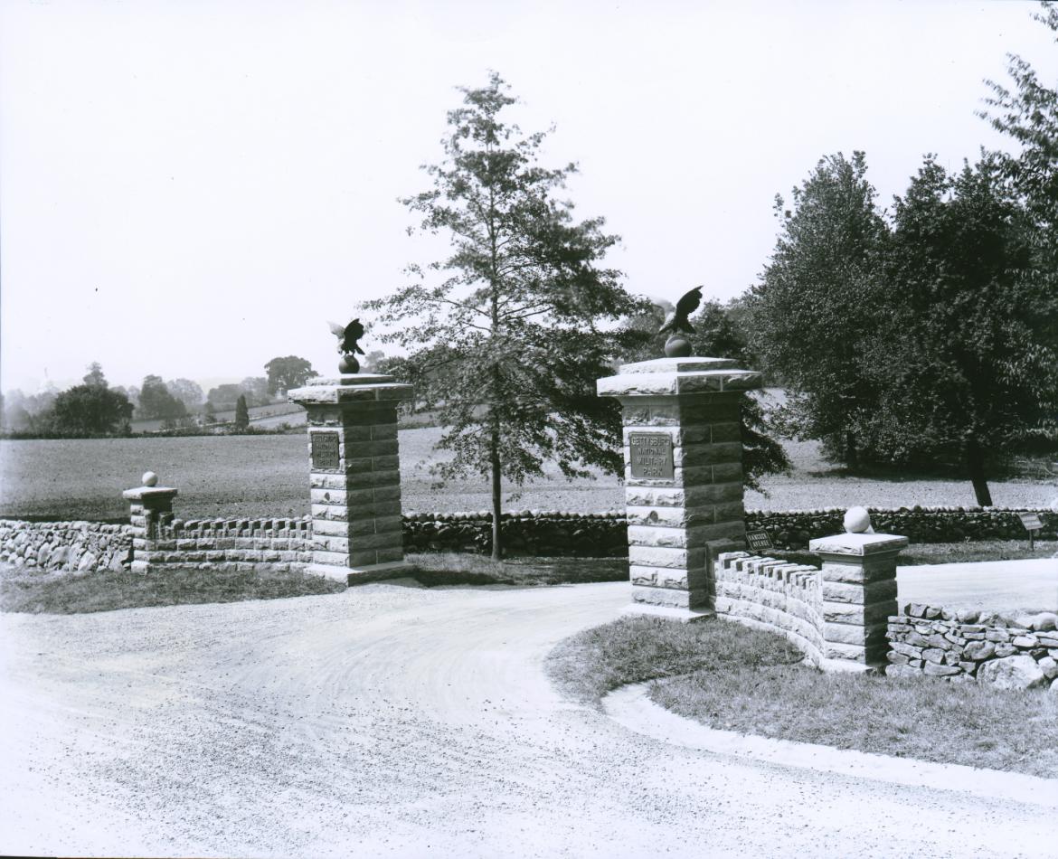
Here is the stone gate that the War Department put up in 1923. It was removed circa 1960 when the National Park Service constructed the Cyclorama parking lot, and moved the entrance to the parking lot farther to the left or south in this view. The National Park Service is putting back a gate that will look like this one, and which will contain some of the same stones. This view was taken facing southwest after 1923 and before 1960.
Here is the “Treatment Plan” for the National Park Service’s project which is titled “Defense of Cemetery Hill- Phase 1.” The orange line shows the route that Hancock Avenue will take through the rehabilitated area. This image was taken facing north at approximately 8:00 AM on Sunday July 24, 2016.
Notice how the new Hancock Avenue, known as “Cross Connector Roadway” in this image will exit out of the current vehicle exit to the Taneytown Road. Only pedestrians will be allowed through the reconstructed Hancock Avenue Gate whose location is marked by the small red star. This image was taken facing north at approximately 8:00 AM on Sunday July 24, 2016.
Recently it has been difficult to find both bases of the posts to the Hancock Avenue Gate. On a stroll along the Taneytown Road stone wall last week, we were not very sucessful. This view was taken facing south at approximately 7:30 AM on Sunday July 31, 2016.
Let’s look to the left side of the orange fencing for the south post of the gate. This view was taken facing west at approximately 7:30 AM on Sunday July 31, 2016.
And here on the left side we have met success. This part of the gate, just to the right (west) of the stone wall has been visible for a long time. This view was taken facing south at approximately 7:30 AM on Sunday July 31, 2016.
Here is the base of the south column of the gate. This view was taken facing southwest at approximately 7:30 AM on Sunday July 31, 2016.
Just to the left of the base to the 1920s column is the foundation for the 1920s stone wall. This view was taken facing southwest at approximately 7:30 AM on Sunday July 31, 2016.
So that was easy. The stone wall on the other (east) side of the Taneytown Road is at the National Cemetery. This view was taken facing east at approximately 7:30 AM on Sunday July 31, 2016.
But where is the foundation for the north column of the gate? We thought that it has been visible in the recent past. This view was taken facing northwest at approximately 7:30 AM on Sunday July 31, 2016.
We couldnt’ find it. Is it underneath the grass, or somewhere in the mud? This view was taken facing northwest at approximately 7:30 AM on Sunday, July 31, 2016.
We looked for it for a little while from multiple angles. This view was taken facing northeast at approximately 7:30 AM on Sunday, July 31, 2016.
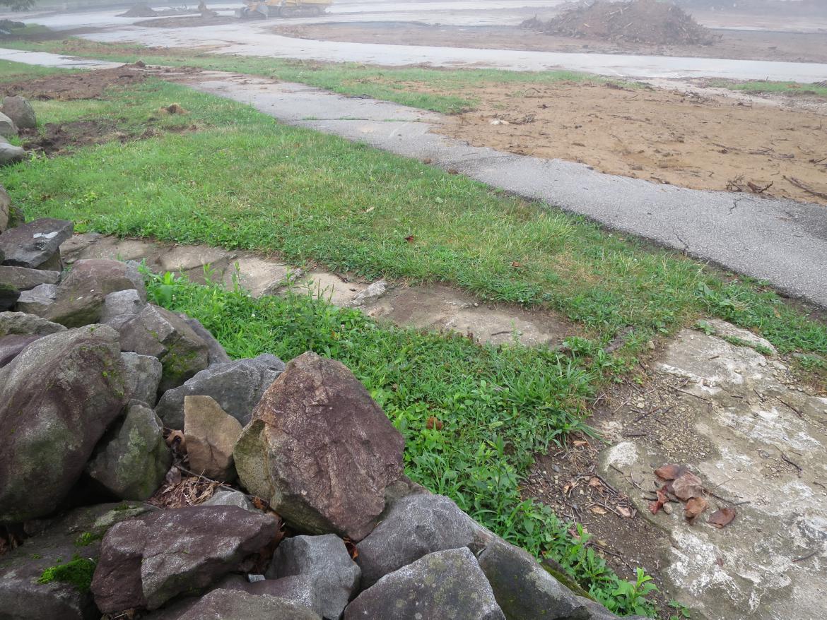
When we came back this week we discovered that the National Park Service had uncovered the north base and the foundation wall. This view was taken facing south at approximately 7:30 AM on Wednesday, August 3, 2016.
Here’s the base of the north column of the gate. This view was taken facing northwest at approximately 7:30 AM on Wednesday, August 3, 2016.
Just north of the base is the foundation for the stone wall which was connected to the 1920s stone gate. This view was taken facing north at approximately 7:30 AM on Sunday, August 3, 2016.
When we stepped it off, the distance from the north column (closest to the camera) to the south column (just visible through the orange fencing on the other side of the sidewalk) is approximately 22 feet. This view was taken facing south at approximately 7:30 AM on Sunday, August 3, 2016.
To give you an idea of the location of the soon to come Hancock Avenue Gate to the entrance of the National Cemetery, we took this photograph. The camera position is at the Taneytown Road entrance to the cemetery. The Hancock Avenue gate location is the orange fencing on the left. The arrow on the pedestrian crossing sign is pointing towards it for us. So visitors will not cross the Taneytown Road at the Hancock Avenue Gate location because it is just over the hill and not very safe. They will still have to cross the road at the top of the hill at the National Cemetery Entrance. This view was taken facing southwest at approximately 7:30 AM on Sunday, August 3, 2016.

