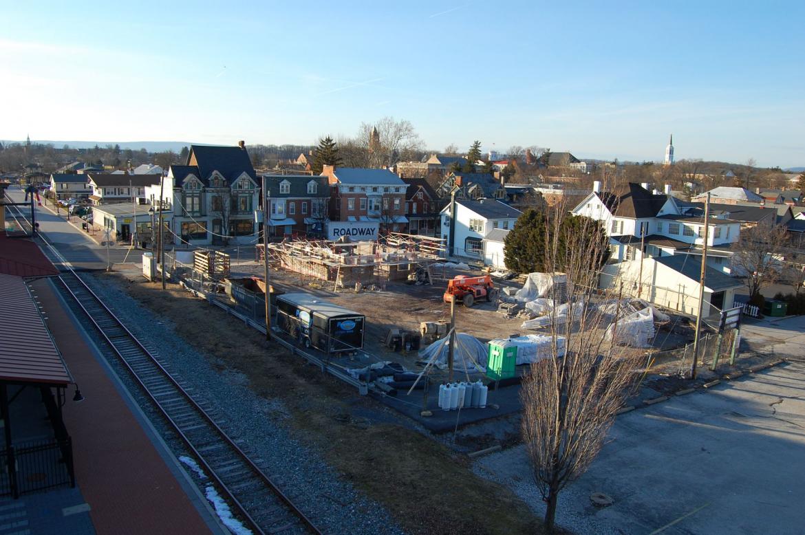
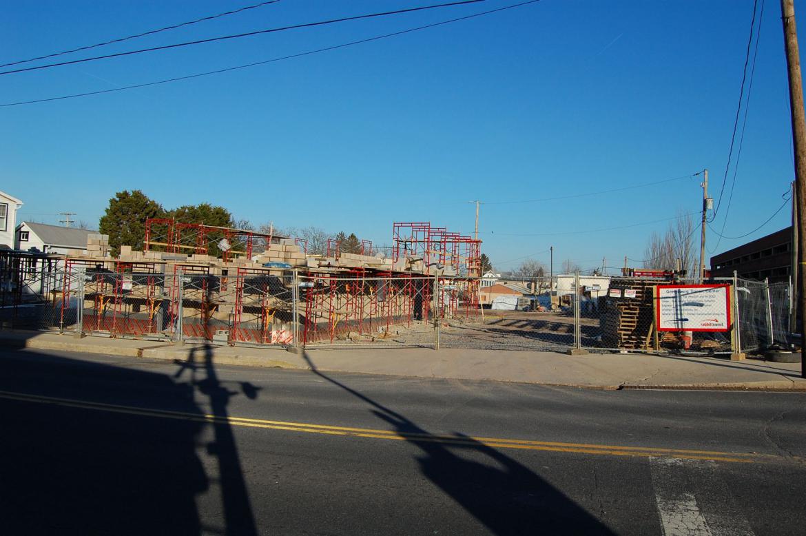
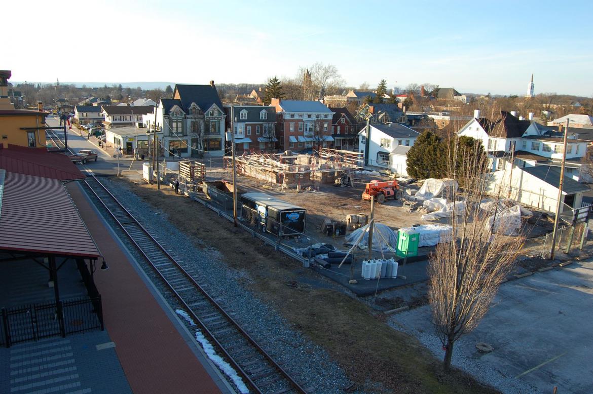
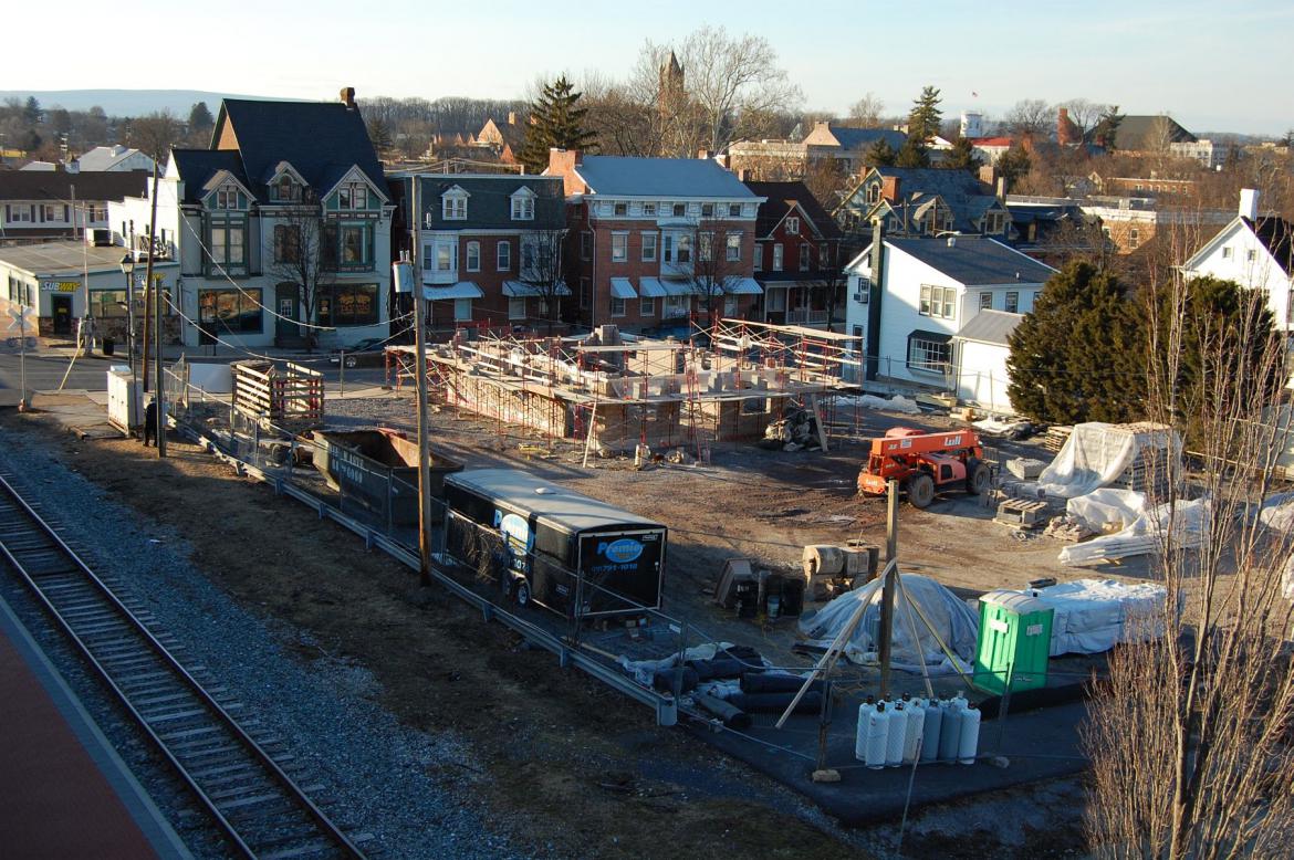
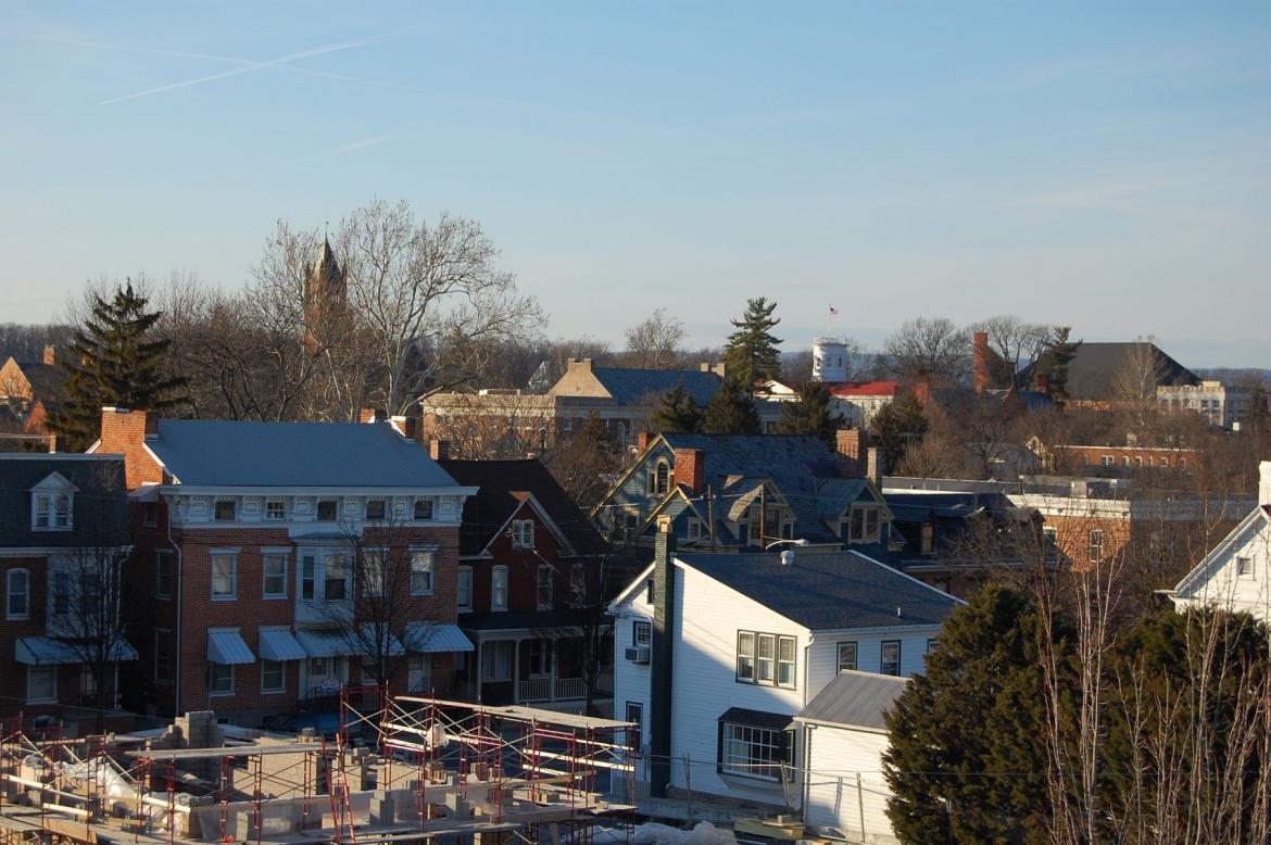
The York Adams Transportation Authority’s “Gettysburg Transit Center” began construction in earnest in the past few weeks on the 1500 square foot property on Carlisle Street in downtown Gettysburg. Notable buildings of Gettysburg College can be seen in the background against the horizon line. This view was taken facing northwest at approximately 4:00 PM on Tuesday, January 31, 2012.
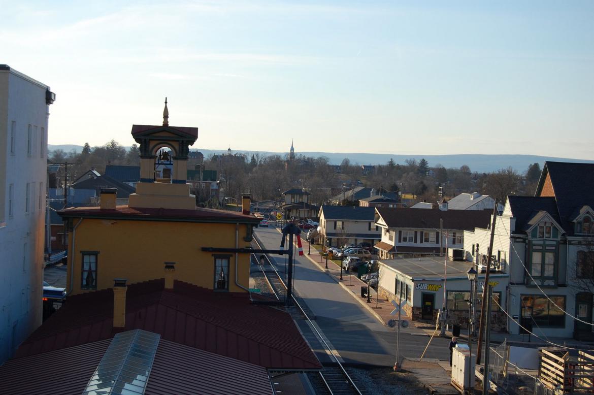
The building is being constructed on the site of what to many Gettysburg residents was for years a Petro gas station. The Gettysburg Train Station, the Majestic Theater, and the Gettysburg Hotel Buildings can all be seen in the right background along Carlisle Street. This view was taken facing southeast at approximately 4:00 PM on Tuesday, January 31, 2012.
If you haven’t been paying attention to this tale of local transit in the past few years, we will catch you up. Years ago, the only transit authority that existed in Gettysburg was called the Adams County Transit Authority, whose primary purpose was to provide paratransit to the disabled and elderly. The more successful York Transportation Authority, known more familiarly to York and Lancaster County residents as Rabbit Transit for its distinct red vehicles, merged with the less-successful ACTA last year (a process began in 2009) to form the current “York Adams Transportation Authority.” This view was taken facing east at approximately 4:00 PM on Tuesday, January 31, 2012.
So what will the purpose of this building be? Currently, there are two primary transit services available to riders — Freedom Transit (the blue ‘trolley’ buses), and the Harrisburg Express (a new express bus from Harrisburg to Gettysburg, much like the existing service from York to Harrisburg). This view was taken facing east at approximately 4:00 PM on Tuesday, January 31, 2012.
The Freedom Transit, or Freedom Trolley, has been making its home here in front of the Majestic Theater. Though the vehicles for the YATA in Gettysburg are still housed for the night in the YATA lot near Dal-Tile east of town, the trolleys often idle here during the day at this transfer center (all three of the system’s lines meet here). This view was facing south at approximately 4:00 PM on Tuesday, January 31, 2012.
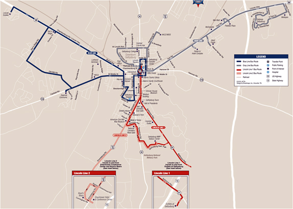
This map shows the three lines offered by Freedom Transit, the Blue Line, which travels west of town to Lincoln Estates, the Red Line or “Lincoln Line,” which serves the Outlet Mall, Eisenhower Hotel, and the Visitors Center (the most trafficked line), and the Gray Line, which goes to HACC, Gettysburg College, and the food and retail east of town on Route 30.
As some of you might know, the trolley system has not been doing well. Initially proposed by the various groups involved in the building of the new Visitors Center as a way to get visitors to and from town now that the old visitor center (which was closer to town) would be replaced, the trolley line was devised to “connect the visitors center to community destinations.” This view was facing south at approximately 4:00 PM on Tuesday, January 31, 2012.
Of course, the transit line couldn’t be called “public transportation,” or receive necessary public funding unless it served living breathing residents of Gettysburg, not just tourists. “This project has evolved, because in order to qualify for long-term rural transportation subsidies from the Commonwealth of Pennsylvania, such a shuttle system must operate year-around, and must serve the entire community (not just park visitors).” This screenshot is from a presentation made to hotels in the area in an effort to increase ridership.
A three year pilot program was started and fares set. Last year, these fares were $3.00 for an all-day ride or $1.00 per trip on one of three lines. The problem? Residents in town didn’t ride it and visitors didn’t ride it either. In 2010 (the first year of the pilot program), the service saw an average of 3 passengers per hour, and their goal for 2011 was to reach 7 passengers per hour. Last year, optimism that maybe the system just needed to work out its kinks faded as it looked like ridership goals, although improving marginally, would not be met (the transit authority was citing an 84% increase as of October, which would put them close to 6 riders per hour). The most used lines on the system have served to shuttle Gettysburg College students from town to Wal-Mart and the Outlet Mall. This view was taken facing northwest at approximately 4:00 PM on Tuesday, January 31, 2012.
Public transportation in the United States has always faced an uphill battle in a nation that still links status and identity to the ownership of motor vehicles. Our tax dollars maintain approximately 3.9 million miles of highways for those cars to drive on. The majority of public transit systems are heavily subsidized by state, local, and federal dollars, even with increased ridership in the last decade due to rising fuel costs for motorists. They are most successful in areas of low income and high population density, or in areas where light/heavy rail systems already exist (which is to say, cities). National passenger rail and bus services, which used to service Gettysburg directly decades ago, now only go to Harrisburg. This view was taken facing northwest at approximately 4:00 PM on Tuesday, January 31, 2012.
A view of the rear of the what the completed transit center will look like.
Most visitors who currently come to Gettysburg get here in one of three ways: 1) They drive their own vehicle 2) They come as part of a tour bus or 3) They fly in to an airport and rent a car and drive it to Gettysburg. It is plain to see from current significant concerns about parking for next year’s 150th Anniversary (which we will be covering next week), that even though optimism remains for the Freedom Transit system and for the local transit system in general, the majority of visitors who will be coming to Gettysburg next summer will be taking their own car. This view was taken facing northwest at approximately 4:00 PM on Tuesday, January 31, 2012.
It’s the hope of the YATA and the Gettysburg Foundation, who has now subsidized ridership on the trolleys (all rides are currently free, courtesy of the Foundation) and taken over operations of the David Wills House from Main Street Gettysburg (which also did not meet visitation expectations), that when visitors do park their cars, they will utilize Freedom Transit. The buildings of the Lutheran Theological Seminary can be seen on Seminary Ridge in the background. This view was taken facing west at approximately 4:00 PM on Tuesday, January 31, 2012.
Until that time however, the only line that could be said to exist exclusively for those who are not tourists or college students, the Blue Line, will likely be closed by April after a reduction in service hours still did not meet ridership numbers. Two weeks ago, employees of the transit authority (one employee can be seen here in the left of frame, taking a look at the new structure) were sent out into the community with door hangers to attempt to attract residents to use the route. It strikes us as sad, that for being a transit authority that is required to serve residents, the only line that existed purely for those residents is on the chopping block. This view was taken facing northwest at approximately 4:00 PM on Tuesday, January 31, 2012.
“The Gettysburg Transit Center will act as a cornerstone of the Gettysburg experience, to provide the visitor and resident the ability to connect to the entire community. This community anchor will complement the adjacent Welcome Center by not only providing transit information, but restroom facilities for the public as well. Funding for the project was provided by the Federal Transit Administration, Pennsylvania Department of Transportation and the Pennsylvania Department of Commerce and Economic Development.” We will keep you updated as this project progresses. Glatfelter Hall, Pennsylvania Hall, and the Musselman Library of Gettysburg College are visible in the rear of this view. This view was taken facing northwest at approximately 4:00 PM on Tuesday, January 31, 2012.

