Gettysburg Daily

Devils Den Restroom Demolished Last Week


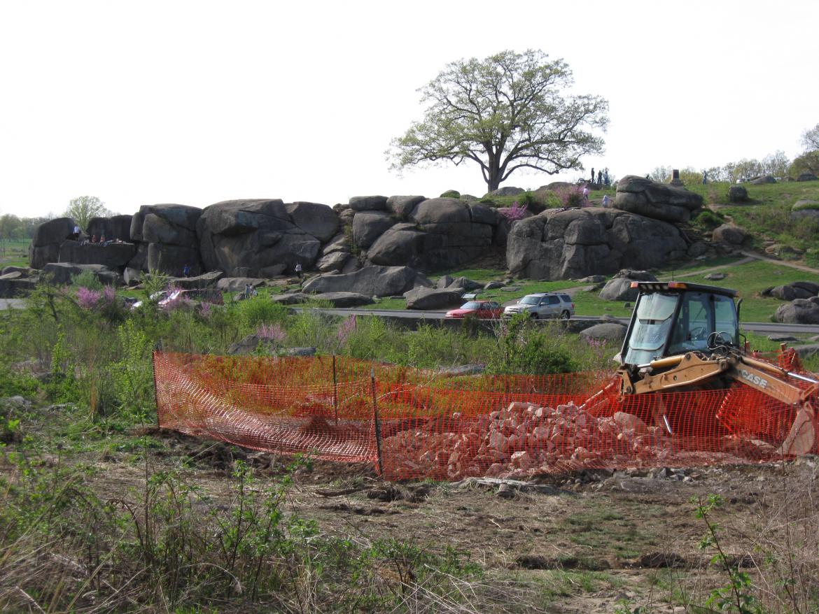
The National Park Service demolished the Devils Den Restroom last week in order to give the “Slaughter Pen” area a look closer to what the soldiers might have seen in 1863. The large rocks at Devils Den are in the background. This view was taken facing west at approximately 4:30 PM on Monday, April 12, 2010.

The National Park Service demolished the Devils Den Restroom last week. We walked around the pile of rubble that is all remaining of the restroom and give you an idea of what the area will look like in the near future.


The National Park Service has closed off the bridge over Plum Run/Bloody Run to deny access to the restroom site from the Devils Den parking lot. However, there are four other trails/paths/roads that lead to the restroom that the NPS didn’t close. We used those. This view was taken facing southeast at approximately 4:30 PM on Monday, April 12, 2010.


The woods of Big Round Top are in the background, as are the utility lines that have not yet been removed. This view was taken facing southeast at approximately 4:30 PM on Monday, April 12, 2010.


This view was taken facing west at approximately 4:30 PM on Monday, April 12, 2010.


The same view, but we are near the trail leading to Big Round Top. This view was taken facing west at approximately 4:30 PM on Monday, April 12, 2010.


Houck’s Ridge is in the background. This view was taken facing north at approximately 4:30 PM on Monday, April 12, 2010.


A closer view of the rubble. This view was taken facing north at approximately 4:30 PM on Monday, April 12, 2010.


Little Round Top is in the background. The purple trees are red bud trees. This view was taken facing northeast at approximately 4:30 PM on Monday, April 12, 2010.


This view was taken facing northeast at approximately 4:30 PM on Monday, April 12, 2010.


Again, the utility lines to the restroom have not yet been removed. This view was taken facing northeast at approximately 4:30 PM on Monday, April 12, 2010.


A view of the “Slaughter Pen” from Houck’s Ridge. Big Round Top is in the background. This view was taken facing southeast at approximately 4:30 PM on Monday, April 12, 2010.

See the following related posts:

Life Imitates Art: NPS Places Port O Potties in the Area of the 20th Maine Monument on April 5, 2010.
Devils Den Restroom Removed and Relocated. And Relocated on April 1, 2010.
Devil’s Den Restroom the Final Months on February 4, 2010.
Power Lines, Ground Disturbance, and the Inadequate Devils Den Restroom on September 5, 2009.
McMillan Woods Water Line Construction Part 2 on August 30, 2009.
McMillan Woods Water Line Construction Part 1 on August 29, 2009.
Horse Trail Construction Near South Confederate Avenue on August 14, 2009.
“We Don’t Think the Park Service Wants You to Take Pictures Here on May 13, 2009.
And the Nomination for Most Thorough Burying of a Flank Marker Goes to… on November 14, 2008.
Patterson Farm Tree Cutting and the left flank marker of Knap’s Pennsylvania Battery thrown in a pile behind the NPS Maintenance Buildings on November 9, 2008.
National Park Service Does Move Flank Markers on October 23, 2008.
National Park Service decision not to move the Reynolds Avenue flank markers on October 22, 2008.
“Do the Flank Markers on Reynolds Avenue Need to be Moved?” on October 16, 2008.
Dirt and Gravel Return to the Flank Markers on October 15, 2008.
Dirt and Gravel Removed from the Flank Markers on October 10, 2008.
Dirt and Gravel Burying the Flank Markers on October 9, 2008.
Doubleday Avenue Roadwork on October 1, 2008.
Asphalt Touches the Flank Marker of the 147th New York on September 30, 2008.
Contractors trying to cover up their mistake of having asphalt touch boulders in The Loop on September 22, 2008.
Slathering the Loop With Asphalt on September 13, 2008.
Devil’s Den: Aftermath of the Construction on September 11, 2008.