National Park Service employee Bob Jones poses next to this section of trunk from the fallen oak tree on Culp’s Hill. This view was taken at approximately 6:00 PM on Thursday, August 4, 2011 and is courtesy of the National Park Service.
Last Thursday, while in the process of removing sections of a fallen oak tree from a boulder near the 66th Ohio Infantry monument, National Park Service maintenance employees discovered bullets within the trunk. They were alerted to the presence of the bullets when their chainsaws had trouble cutting through the oak. Today we’ll show you how to get to the tree and take a look at what remains on the scene.
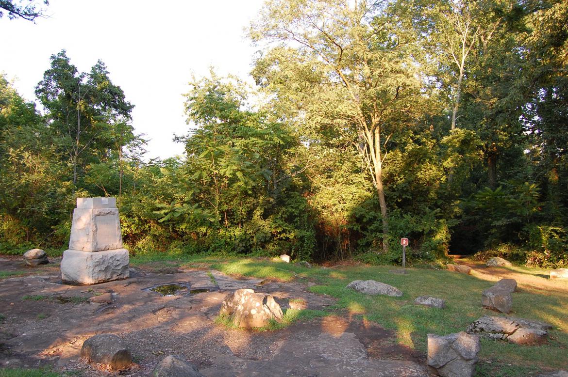
It was getting dark as we parked at the summit of Culp’s Hill near the observation tower. This view was taken facing northwest at approximately 7:00 PM on Tuesday, August 9, 2011.
To get to the fallen witness tree, we will take the hiking trail in the center of this photograph to the left of the small brown sign. This view was taken facing east at approximately 7:00 PM on Tuesday, August 9, 2011.
The trail is next to the marker to Knap’s Pennsylvania Battery E … This view was taken facing northeast at approximately 7:00 PM on Tuesday, August 9, 2011.
… and is just nearby its right flank marker. This view was taken facing northeast at approximately 7:00 PM on Tuesday, August 9, 2011.
Let’s head down the trail. This view was taken facing east at approximately 7:00 PM on Tuesday, August 9, 2011..
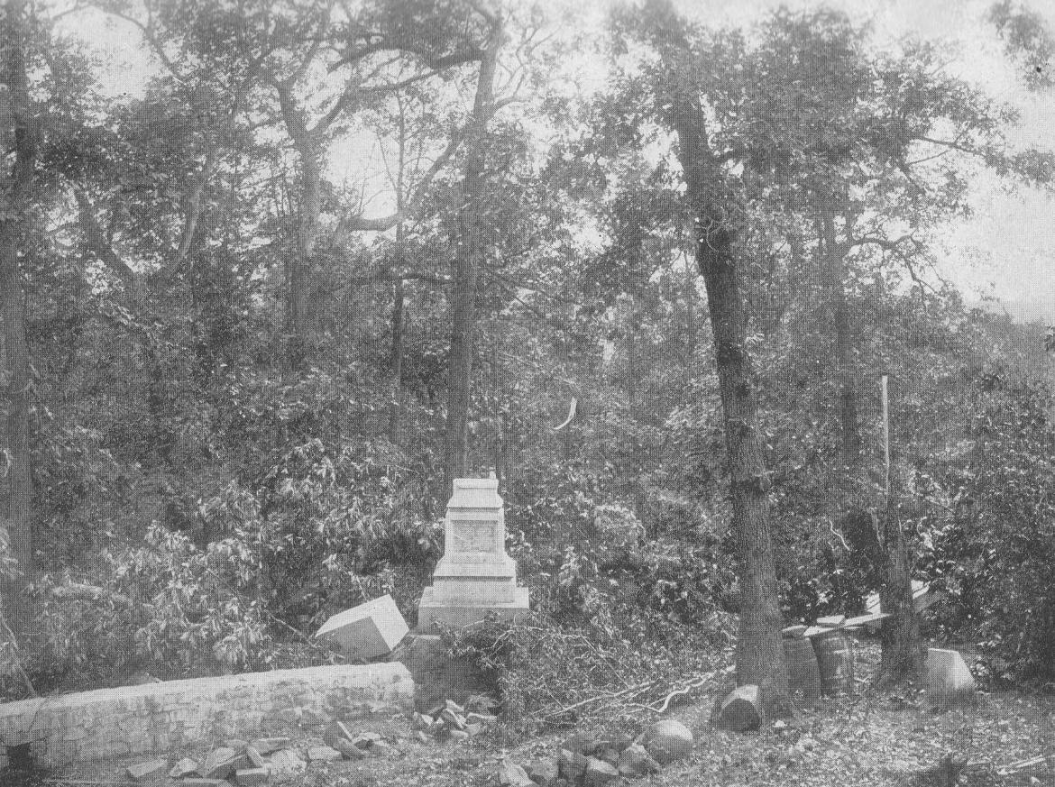
The 66th Ohio monument was crushed by falling trees in a large storm caused by a hurricane on September 30, 1896. It is possible that the witness tree with bullets in the trunk is visible in this photograph, though it is difficult to distinguish in the background behind the monument. “The hurricane of last month destroyed many hundreds of trees on the battlefield, which we shall take measures to replace.” (Gettysburg National Military Park Commission Report page 39) “The Fury of the Storm. The most devastating storm that every visited this community fell upon us on last Tuesday night with the fury of a hurricane, unroofing buildings, twisting off and uprooting trees and laying fences flat. The greatest damage done here was in the northern part of the town…. Numbers of trees damaged on the Battlefield: Reynolds’ Grove… 12 Blown over, 31 Broken Off and will have to be cut down. Schultz’s Grove… 0 Blown over, 1 Broken Off and will have to be cut down. Ziegler’s Grove… 0 Blown over, 1 Broken Off and will have to be cut down. Culp’s Hill… 120 Blown over, 93 Broken Off and will have to be cut down. McAllister’s Woods… 1 Blown over, 0 Broken Off and will have to be cut down. Round Top Park… 32 Blown over, 40 Broken Off and will have to be cut down. Little Round Top… 41 Blown over, 51 Broken Off and will have to be cut down. Big Round Top… 135 Blown over, 99 Broken Off and will have to be cut down. Between Round Tops… 38 Blown over, 0 Broken Off and will have to be cut down. Along Sickles Avenue 54 Blown over, 26 Broken Off and will have to be cut down. Bushman Woods… 48 Blown over, 44 Broken Off and will have to be cut down. Along Confederate Avenue… 13 Blown over, 4 Broken Off and will have to be cut down. Roof blown off tower at the Bryan House. Piece of roof off tower at Starner’s. The monument of the 66th Ohio Regiment, on Culp’s Hill, was ruined by huge trees which fell upon it. The monuments of the 102d and Seventy-eighth New York Regiment were slightly injured, but can be repaired. The fine avenue of Norway maple trees in the National Cemetery was nearly destroyed, many of the largest limbs having been torn off.” (Gettysburg Star and Sentinel October 6, 1896, page 3, column 4) This image was taken facing southeast circa 1896. Annual Reports of the Gettysburg National Military Park Commission to the Secretary of War, 1893-1904. Washington. Government Printing Office, 1905.
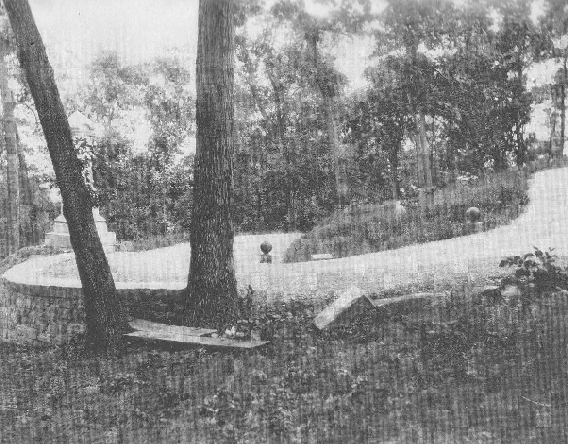
This area was not always overgrown — at one point Slocum Avenue ran along this portion of the hill, which explains the location of these monuments today. The 66th Ohio monument, dedicated in 1887, is behind the tree in the left background. The Annual Report of the Gettysburg National Military Park Commission to the Secretary of War in 1897 states: “Since the last report Slocum avenue, then under construction, has been completed. It leads from the Baltimore pike at the base of East Cemetery Hill over the summit of Culp’s Hill to its southeastern base at Spanglers Spring, closely following and marking the main battle line of the right wing of the Union Army.” (page 37) This photograph was taken facing southeast circa 1897. Annual Reports of the Gettysburg National Military Park Commission to the Secretary of War, 1893-1904. Washington. Government Printing Office, 1905.
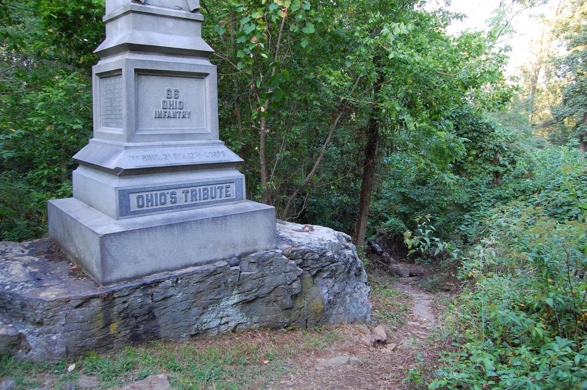
Here is the 66th Ohio monument today. This view was facing east at approximately 7:00 PM on Tuesday, August 9, 2011.
The fallen witness tree is near the Palmer marker, located further down the trail. This view was facing east at approximately 7:00 PM on Tuesday, August 9, 2011.
The Palmer marker is now visible in the center of this photograph. The root system of the fallen oak tree is also visible just to its left. This view was taken facing east at approximately 7:00 PM on Tuesday, August 9, 2011.
The downed tree trunk in the left section of this photograph is the witness tree. This view was taken facing northeast at approximately 7:00 PM on Tuesday, August 9, 2011.
We are now looking at the trunk of the fallen witness tree, with the 66th Ohio in the left background. This view was taken facing west at approximately 7:00 PM on Tuesday, August 9, 2011.
The Palmer marker, which indicates the falling of Maj. J.G. Palmer of the 66th Ohio was among the monuments infamously vandalized by oil in November of 1999. A section of the witness tree sits to the left of the marker on top of the boulder. This view was taken facing northeast at approximately 7:00 PM on Tuesday, August 9, 2011.
There were three sections of tree trunk remaining. The National Park Service removed two sections of “the tree trunk where the bullets were discovered [to the] park’s museum collections storage facility.” This view was taken facing north at approximately 7:00 PM on Tuesday, August 9, 2011.
This view was taken facing northeast at approximately 7:00 PM on Tuesday, August 9, 2011.
The story was picked up by many major news outlets and made the MSNBC Nightly News with Brian Williams. If you are visiting this page and the video above does not work, we plan on replacing this with an archived version of the clip once it has been removed from MSNBC’s content servers.
It was getting dark, so we figured it was time to head back. Kudos to the National Park Service for the preservation of the Civil War artifacts discovered here. This view was taken facing west at approximately 7:00 PM on Tuesday, August 9, 2011.


