A detail from an 1888 panoramic view of Gettysburg, Pennsvylania.Little Round Top (left) and Big Round Top (right). This panoramic map was drawn by T.M. Fowler in 1888 [LOC].
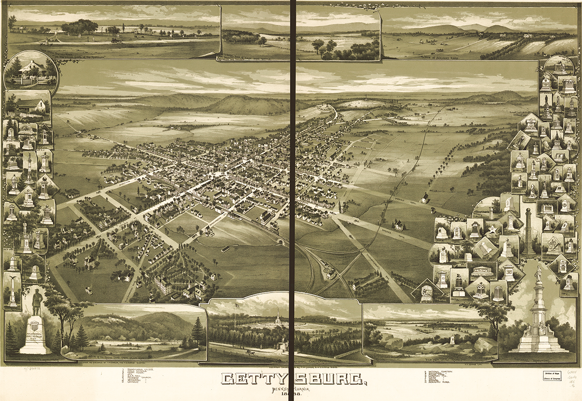
In the late 19th and early 20th centuries hand-drawn bird’s-eye views of local towns and communities were popular. Taking an imaginary vantage point from the air, the artists were able to give townspeople an idea of what their community looked like from the sky. One of the more well-known producers of these hand-drawn lithographs was Thaddeus Mortimer Fowler. Fowler drew this bird’s-eye view of Gettysburg in 1888, fifteen years before the first powered flight in an airplane. Remember you can click on this image (and all of our images) to enlarge it.“From 1887 through 1906 Fowler concentrated on the state of Pennsylvania, where over the twenty year stretch he managed to produce over 200 maps of cities spanning the entire state.” This panoramic map was drawn by T.M. Fowler in 1888 [LOC].
Fowler did represent a few monuments on the map, many of which were being erected during the time he spent researching and drawing. The 55th Ohio can be seen at the corner of the Taneytown Rd and Emmitsburg Rd. The 73rd Ohio can be spotted in its original location on the Taneytown Road along the wall for the Soldiers National Cemetery. You can also spot the well and reservoir on East Cemetery Hill.This panoramic map was drawn by T.M. Fowler in 1888 [LOC].
The town square is in the bottom left of this detail. If you can find the structure with the number 4 written on it (top center), you’ve found the jail and accompanying wall.This panoramic map was drawn by T.M. Fowler in 1888 [LOC].
Heckman’s Battery K without guns is on the left at the corner of Lincoln Avenue and Carlisle Street. Stevens Hall and the Gettysburg College Observatory are both prominently featured on the left side of this detail.This panoramic map was drawn by T.M. Fowler in 1888 [LOC].
The 1st Ohio Light Artillery Battery K (Heckman’s Battery) is one of many monuments rendered along the map’s border. At the bottom of this detail, the 17th Connecticut Infantry.This panoramic map was drawn by T.M. Fowler in 1888 [LOC].


