One of our goals on the visit to Manassas National Battlefield was to capture scenes in the final hours of daylight on July 21st, the 150th anniversary of the First Battle of Manassas. The location is Henry Hill. The monument to Thomas J. “Stonewall” Jackson is on the left. The 1870 Henry House is on the right. This view was taken facing west at approximately 8:15 PM on Thursday, July 21, 2011.
The Gettysburg Daily decided on Thursday, July 21, 2011 that after finishing their tours at Gettysburg to drive to Manassas. The goal was to stand on the ground on the 150th anniversary of the Battle of First Manassas, to document the scene, and to avoid the crowds.
In today’s post we show the structures that were put in place for the commemoration ceremonies of the 150th Anniversary of the Battle of First Manassas (First Bull Run).
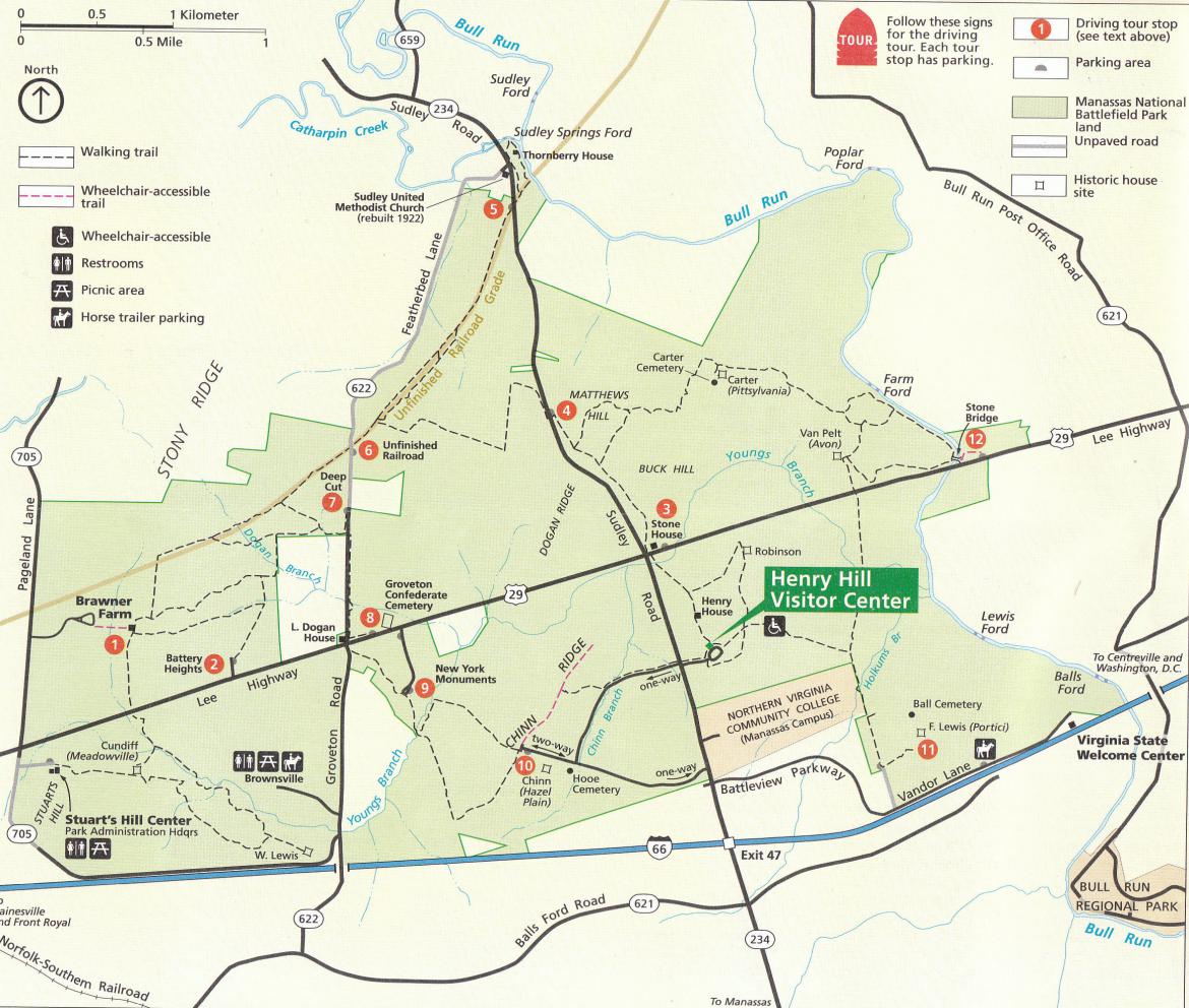
This is the National Park Service Map of Manassas National Battlefield. Most of the map shows areas concerning the Second Battle of Manassas, which was fought from August 28-30, 1862. Today, we are concerned about the First Battle of Manassas, which was fought on July 21, 1861. This final stages of the battle centered around the Henry Hill area, shown in the bottom right of the map. This map was scanned facing north at approximately 11:00 AM on Friday, July 22, 2011.
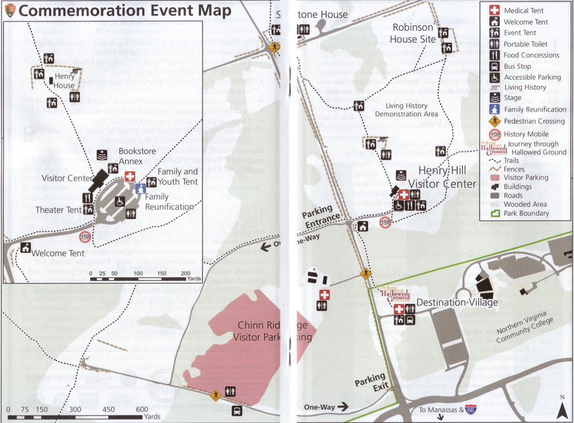
This is the National Park Service Map of the area around Henry Hill for the 150th anniversary period. Large tents, tractor trailers, Coca Cola trucks, Pepsi trucks, food stands, etc… dot the hill of the first major land battle of the American Civil War. So if you had thoughts of going to the battlefield and to be transported back in time 150 years ago, that was difficult. This map was scanned facing north at approximately 11:00 AM on Friday, July 22, 2011.
This is the welcome tent located at the entrance to Henry Hill. The Manassas-Sudley Road is in the right background.This view was taken facing southwest at approximately 8:30 PM on Thursday, July 21, 2011.
Near the top of the hill was the Civil War 150 HistoryMobile Exhibition. The HistoryMobile consists of four sections: Why War?, Battlefront, Homefront, and Slavery. This view was taken facing southwest at approximately 8:15 PM on Thursday, July 21, 2011.
The Pepsi and Coca Cola trucks on top of Henry Hill made a nice addition to the scene. We guess to give visitors another view of which purpose the soldiers were fighting. This view was taken facing south at approximately 8:30 PM on Thursday, July 21, 2011.
The Manassas National Battlefield Visitors Center was constructed in 1942. This week it was surrounded by more tents. This view was taken facing northeast at approximately 8:30 PM on Thursday, July 21, 2011.
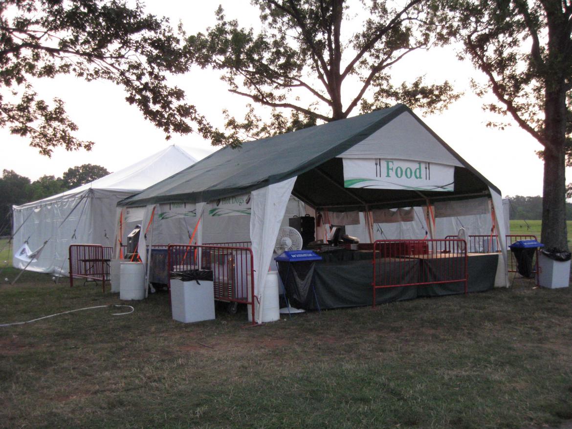
The large white tent on the left is a theater tent showing a 3-D Video that includes more than twenty stereographs taken in the Manassas area in 1862. The presentation lasts six and a half minutes. This view was taken facing northwest at approximately 8:30 PM on Thursday, July 21, 2011.
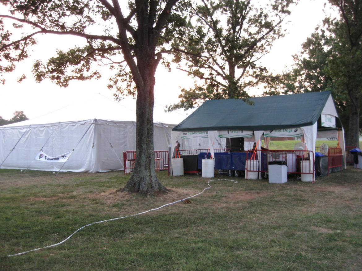
This tent, selling hot dogs, water, and sandwiches made us feel like we were right back in the Gettysburg National Military Park Visitors Center.This view was taken facing west at approximately 8:30 PM on Thursday, July 21, 2011.
The small yellow tent is a “Cooling Tent.” Much needed since temperatures/heat index reached over 100 degrees at Mannasas on this day.This view was taken facing northeast at approximately 7:00 PM on Thursday, July 21, 2011.
Plenty of Port O Potties were spread around the Henry Hill area.This view was taken facing northeast at approximately 6:30 PM on Thursday, July 21, 2011.
Visitors during the day were required to park in the Chinn Ridge area. This shuttle bus, usually used at Harpers Ferry, transported them to Henry Hill. In the right background is the “Family Reunification” Tent. In the left background is the First Aid Tent. This view was taken facing northeast at approximately 6:30 PM on Thursday, July 21, 2011.
The Visitors Center was still open when we arrived.This view was taken facing southwest at approximately 6:45 PM on Thursday, July 21, 2011.
We exited the Visitors Center on the back porch. The First Aid Tent is located here. The C-SPAN satellite truck is in the left background.This view was taken facing southwest at approximately 7:00 PM on Thursday, July 21, 2011.
On the back of the Visitors Center, a huge stage was erected for the commemoration ceremonies which took place earlier that day.This view was taken facing southwest at approximately 8:00 PM on Thursday, July 21, 2011.
There was plenty of seating for visitors. The Stonewall Jackson statue is in the center background. The light colored monument in the right background is to Barnard Bee. This view was taken facing northeast at approximately 6:45 PM on Thursday, July 21, 2011.
There were multiple stages around the seating area. This view was taken facing east at approximately 8:00 PM on Thursday, July 21, 2011.
Speaking of what happened here 150 years ago, here’s a witness tree from the time of the battle. This view was taken facing east at approximately 8:00 PM on Thursday, July 21, 2011.
The National Park Service is attempting to prolong its life with cables. This view was taken facing east at approximately 8:00 PM on Thursday, July 21, 2011.
The trunk of the tree has already had multiple branches “pruned” over the years. This view was taken facing south at approximately 8:00 PM on Thursday, July 21, 2011.
The tree is not too far from the Visitors Center.This view was taken facing southwest at approximately 8:00 PM on Thursday, July 21, 2011.
We’ll now start to walk towards the Henry House through the lines of Rickett’s Battery.This view was taken facing northwest at approximately 7:00 PM on Thursday, July 21, 2011.
Not too far from the Visitors Center is a wayside exhibit for Rickett’s Battery.This view was taken facing southeast at approximately 7:00 PM on Thursday, July 21, 2011.
Captain James B. Ricketts commanded Battery I, 1st United States Artillery. He was wounded four times and captured at the Battle of First Manassas when his battery was overrun by Confederate infantry. This view was taken facing east at approximately 7:00 PM on Thursday, July 21, 2011.
Behind one of Ricketts’ guns is a plaque and a small marker. This view was taken facing southwest at approximately 8:00 PM on Thursday, July 21, 2011.
The 7th Georgia was in George T. Anderson’s Brigade at the Battle of Gettysburg. At Gettysburg they fought on the south end of the battlefield in the area known as South Cavalry Field. This view was taken facing west at approximately 7:00 PM on Thursday, July 21, 2011.
Here’s the marker showing where they captured Ricketts’ Battery. This view was taken facing west at approximately 8:00 PM on Thursday, July 21, 2011.
The 7th Georgia belonged to Colonel Francis S. Bartow’s Brigade. They charged out of the woods in the left background towards Ricketts’ Battery. We’ll show you more about Bartow at Manassas in a later post. This view was taken facing east at approximately 8:00 PM on Thursday, July 21, 2011.
The position of the gun limber and the caisson and its limber marking the position of Ricketts’ Battery in reltionship to the Visitors Center. This view was taken facing east at approximately 8:00 PM on Thursday, July 21, 2011.
Behind Ricketts’ Battery is another plaque. This view was taken facing west at approximately 8:00 PM on Thursday, July 21, 2011.
First Lieutenant Andrew Douglas Ramsay was a son of Captain William Ramsay, United States Navy. He was commissioned a second lieutenant in the First United States Artillery June 7, 1855. On the eve of the Civil War he served at Fort Duncan, Texas under then Captain William H. French. He was promoted to first lieutenant on February 25, 1861 and left Texas on the S.S. Daniel Webster on March 19, 1861. At the Battle of First Manassas, Lieutenant Ramsey was killed by a Confederate sharpshooter while attempting to recover the guns of the wrecked battery during a Union counterattack. This view was taken facing west at approximately 8:00 PM on Thursday, July 21, 2011.
Ricketts’ Battery consisted of six ten-pounder Parrots. Here is the relationship of the Ramsay marker to the battery and the Visitors Center. This view was taken facing southeast at approximately 8:00 PM on Thursday, July 21, 2011.
Down the slope from the Ramsey marker are the tents for the support personnel who were attempting to keep order during the Manassas events. This view was taken facing southwest at approximately 7:00 PM on Thursday, July 21, 2011.
In our next Manassas post, we’ll show you the activity around the Henry House. This view was taken facing northwest at approximately 7:00 PM on Thursday, July 21, 2011.


